Precise piloting.
Let us guide you.
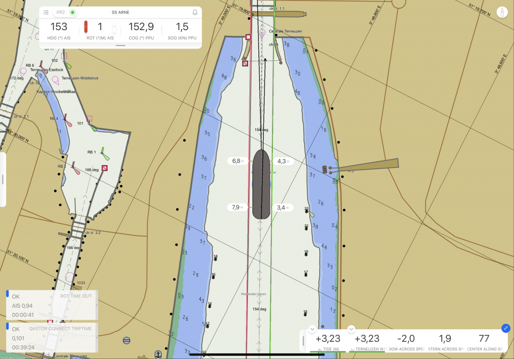
Precise piloting with under-keel clearance capability and real-time information updates. The ultimate in maritime safety.
Contact Sales Free trial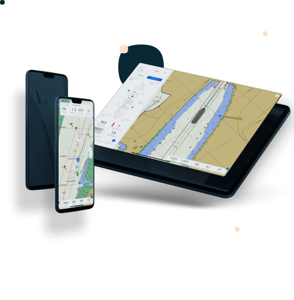
This site uses cookies to create a greater user experience. Read more
Precise piloting with under-keel clearance capability and real-time information updates. The ultimate in maritime safety.
Contact Sales Free trial
Qastor presents the utmost in planning, awareness, and safety.
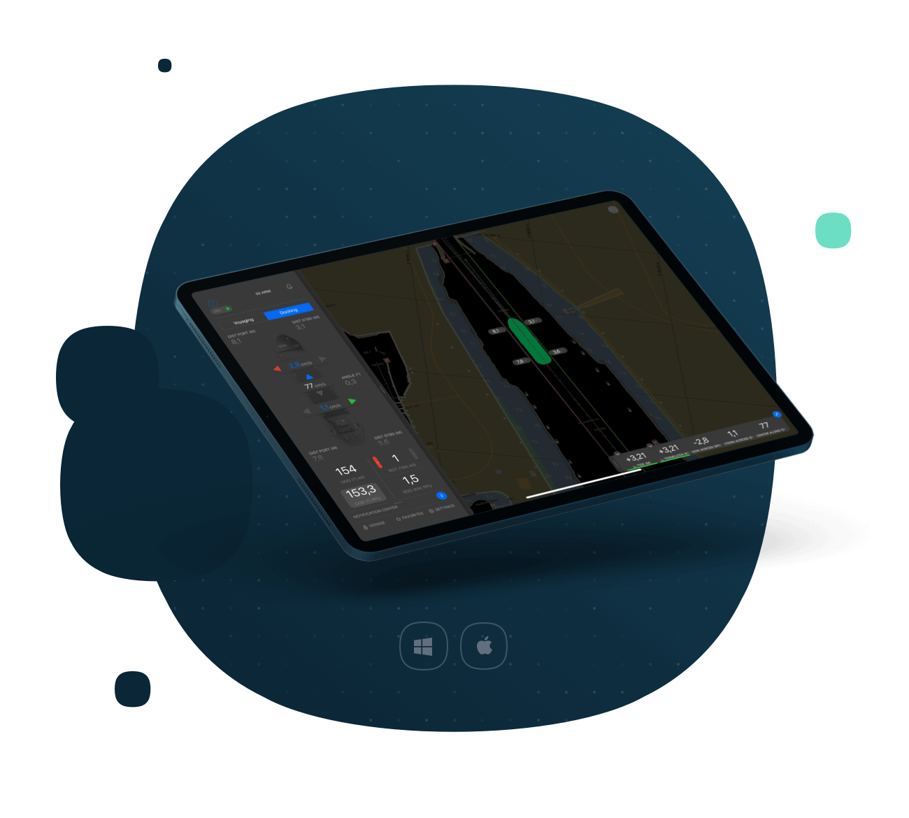
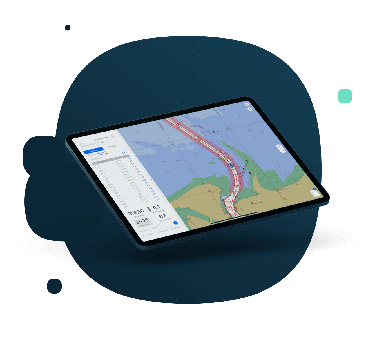
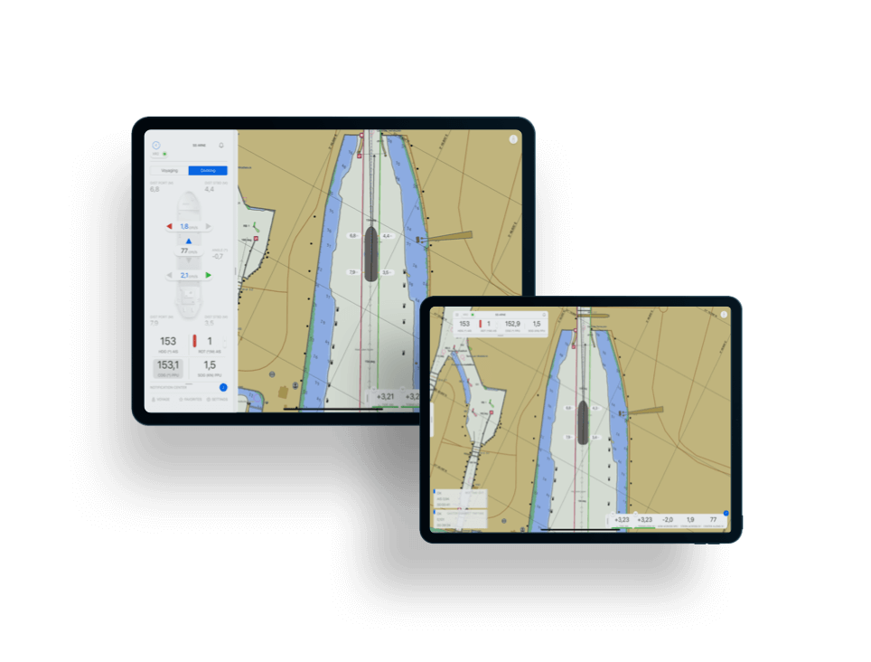
Qastor is a precise navigation, piloting and docking software application capable of receiving real-time meteorological information and chart updates via the Connect Server.
A precise navigation software for piloting and docking, and with Under Keel Clearance capability and modes customized to specific, critical operations, Qastor also supports high-resolution overlays to expand navigable water, and real-time meteorological updates via the Connect Server, resulting in optimal situational awareness for pilots.


Everything a pilot needs to ensure safety of life at sea.
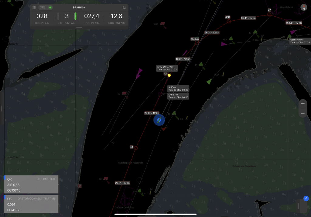
Vessel information
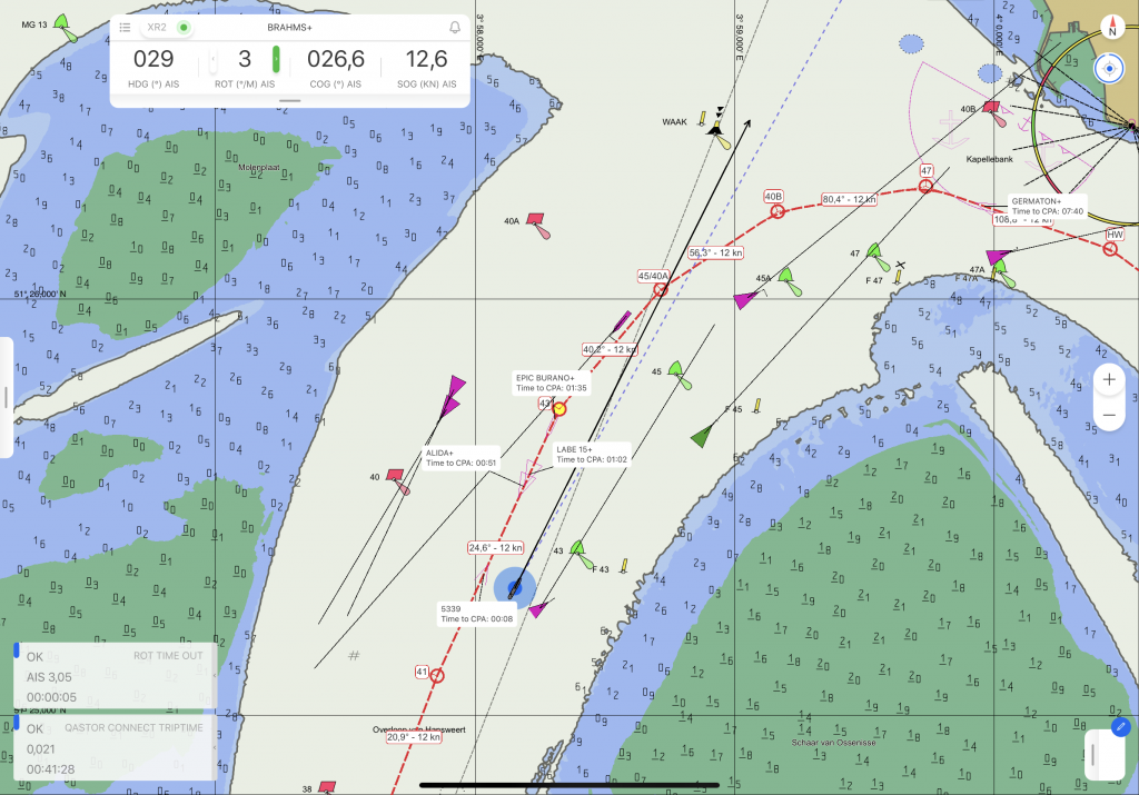
Real-time motion parameters in addition to dynamic Under-keel Clearance capabilities.
Real-time information
Receive AIS, port VTS information, ENC distribution, and environmental updates.
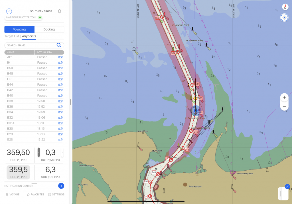
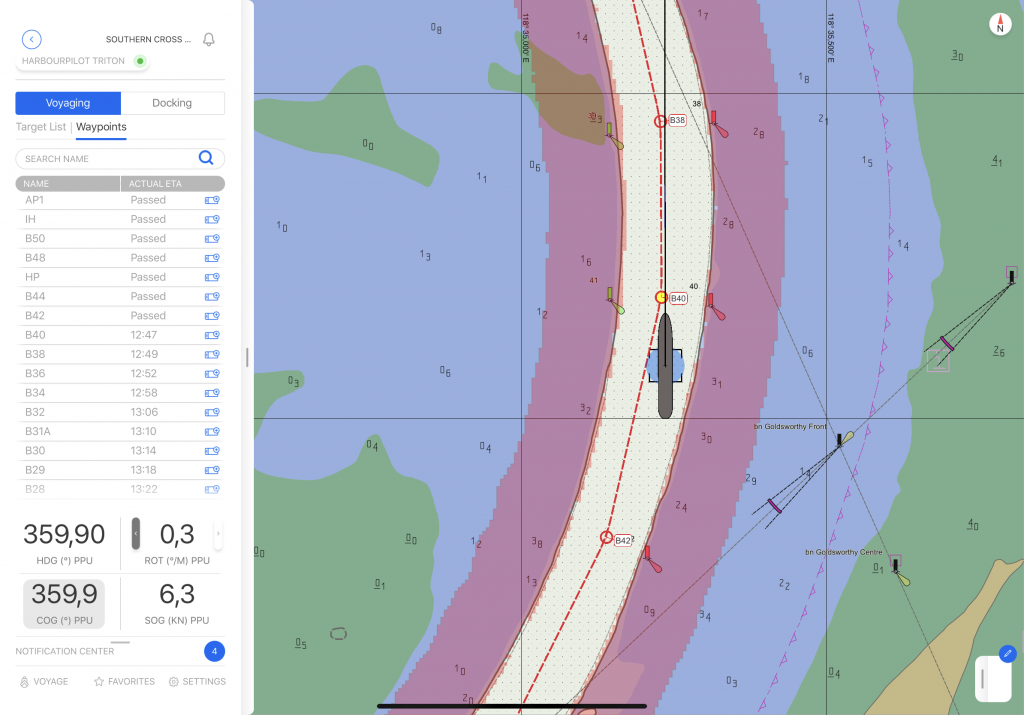
Route planning and verification based on vessel characteristics.
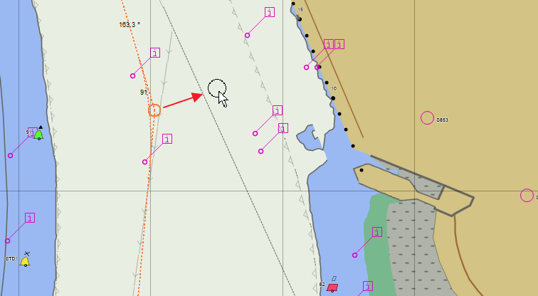
Ensure safe water
Under-keel clearance uses vessel draft, required safety margin, and ENC contours to verify route.
Route planning
Set waypoints include distance off-track, wheel over line, and much more.
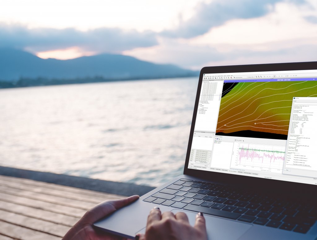
Utilize high-resolution chart products, and embrace custom modes for docking and other maritime operations.
High-resolution support
Expand navigable waters and aid ship movement with high-resolution ENC compatibility.
Custom modes
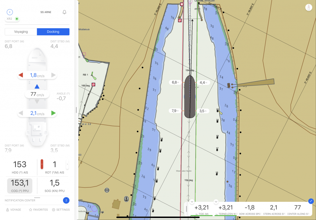
Docking; Lock approach; Floating Production, Storage, and Offloading (FPSO), and Single Point Mooring (SPM) mode support.


Know your vessel, port, environment, and the situation better than ever before.
Path prediction
Path prediction based on vessel speed, course over ground, and heading.
Connect Server
Receive in real-time port Vessel Traffic System information, updated ENCs, currents, wave heights, wind speed and direction.
We're flexible. Licenses available by subscription, as perpetual, or on a rental basis.
What's best for you? Softlock and dongle options are available.
We're ready to assist. Licenses include online and phone support services.
Never get behind. Licenses include access to our latest updates and features.
We innovate. Licenses keeps you on the cutting edge of the industry.

Everything you need to know about Qastor is below, with regards to specifications, supported platforms, system requirements, and supported file formats.
All specifications.Precise navigation
Precise navigation for piloting, docking, ship trials, oil rig positioning, inland river barges, SPM approaches, ferry operations, oil and gas tanker approaches and docking, patrol vessels and tugboat operations.
QPS Connect Server
Qastor receives port Vessel Traffic System (VTS) information, updated ENCs, chart annotations included digital pictures, and meteorological data to include real-time information about currents, wave height, wind speed and direction from the Connect Server.
Wireless support
Wired or wireless operation is supported.
Interfacing
Interfaces to most devices outputting NMEA data strings and to AIS transponders/receivers.
Real-time display
Vessel speed, heading, course over ground (COG), and rate of turn (ROT).
Chart display
All popular electronic formats, including S-57, Primar, C-MAP, ARCS, and DENC.
Under-keel clearance
Under Keel Clearance (UKC) capability uses vessel draft, required safety margin, and ENC contours to show safe water.
Path prediction
Vessel path prediction for a user-defined period of time base don speed, COG, and heading.
Want to give our software a spin? See what it’s like in real life or just test its capabilities. Try it out today!
Get free trial